Mapping By Computer
Dr. Herb Spady
Salem, Oregon
Mapping your garden on computer has several advantages. The most significant is that changes are easily made when plants die or are moved. Changes in bed size and shape are easily adjusted. The map creates a permanent record so that when labels are lost or become illegible the plant is still identified. One can conveniently print out the map at any time.
The first step in creating the maps on computer has nothing to do with the computer itself, but rather gathering the data for creating the plot maps. This can be done with sophisticated instruments like surveying transits or simply with a tape measure. I have found that a good compass that allows sighting is an inexpensive compromise for the surveying instruments. Such compasses are physically constructed so that they can be placed on a standard such as a tripod and one can look through sites on the compass to obtain relatively accurate readings of directions. Begin by identifying true north or some convenient landmark. If the map is just for your own use this may not be necessary. If the map is of a garden open to the public it is necessary to orient the beds to some conspicuous landmark such as a building. It is easy to become completely disoriented in a large garden without such orientation, as the bed shapes may not allow all beds to be positioned on the page with the same orientation.
If one feels incompetent for the task of obtaining such data it can be done professionally. If one has an aerial photograph of the property the plot map can be made from that.
Beds are best defined by natural boundaries such as paths or buildings. Sometimes beds are simply too large or the natural boundaries are not a convenient shape to put on a standard size paper. It may then be necessary to create artificial boundaries. Bed size is best not too large so that the names or numbers of the plants are not crowded.
Once you have the data for the boundaries, shapes and sizes of the bed create a plot map with all the beds on it. They may be designated by number, name or any other way you choose.
OOPs! I said create a plot map. That means that you are now into the use of the computer. Mapping on the computer can be done with most any drawing program. Some are much more difficult to use than others. Although maps can be created with bitmap drawing programs, greater accuracy and ease of use is obtained with vector graphics programs.* The one that I have used mostly is Designer
©
(Micrografx Inc., 1303 Arapaho Road, Richardson TX 75081). The least expensive vector graphics program I have encountered is ARTS & LETTERS EXPRESS
©
(Computer Support Corp., 15026 Midway Road, Dallas TX 75244). This is a shareware program that sells for about $100. I am sure there are others, but I have no experience with them.
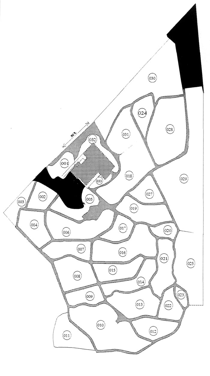
|
| Fig 1. Plot map of all the beds in the Cecil & Molly Smith Garden. |
After creating the plot map which includes all the beds extract each individual bed from the plot map. This is easily done with the graphics programs as each bed can be created as an individual object. The bed map can then be enlarged to the full size of the paper being used (usually 8.5" x 11"). It is on the individual bed maps that you will want to identify the location of each plant.
Mapping with the names of the plants on the map is often too space consuming. It is best done with a numerical designation for the plant and a facing page with numbers associated with plant names. Since printing will likely be done on standard letter size paper it may be necessary to rotate the bed map to fit on the paper creating an image as large as possible. This is when the landmark becomes important. Note on the sample from the Cecil & Molly Smith Garden that an arrow indicates the direction of the house.
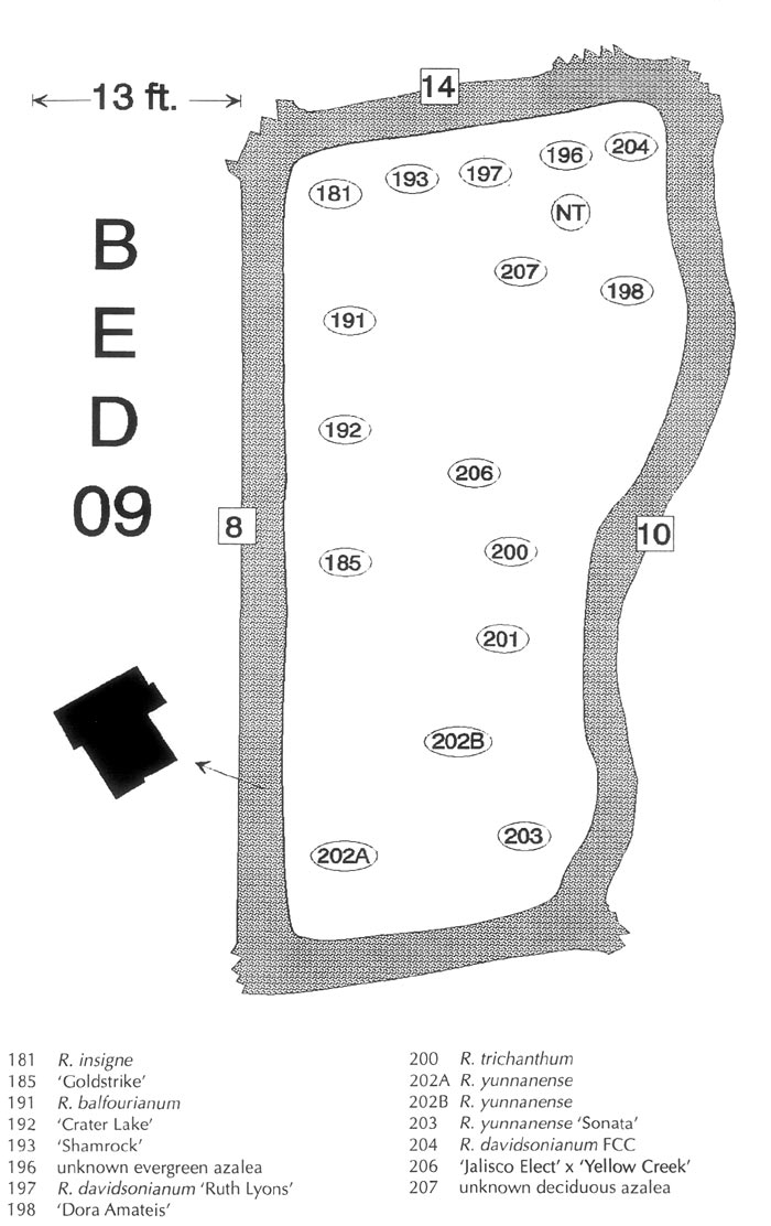
|
|
Fig 2. Typical Plot map of a bed. The numbers at the edge
of the Bed 9 refer to the numbers of the adjacent beds. |
If one has their rhododendrons identified by number and bed in a database it is simple to print a list of the plants to a file for each bed. The file can then be alphabetized (numberized). So that the plants are easily referenced on the map, as illustrated in the sample from the Smith Garden.
Some of the programs allow layering. It is then possible to create separate layers in the file for trees, companion plants, sprinklers or any other items in the garden. Such mapping is especially useful for underground wiring or pipes, since one soon forgets their locations. If the programs do not accommodate layering separate files can be created for each group of items using the same plot or bed maps.
* Bitmap programs describe each dot on the screen as to color and position. Vector graphics programs describe each object (circle, square, irregular outline, etc.) as a mathematical formula. Each such object is independent of all other objects and can be easily manipulated. They can be changed in size, shape and position. Most all vector graphics programs allow for layering.
Dr. Spady, a member of the Willamette Chapter, is Past President of the ARS.